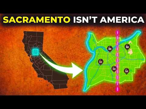
Every major American city follows the same three rules: grow toward your water, sprawl out evenly in all directions, and build on solid ground. Sacramento breaks all three. When a catastrophic river flood rose up to drown the settlement, Sacramento refused to move. Instead, it reached down, jacked its entire downtown ten feet up into the air, and kept doing business while lifting itself out of the mud.
In this urban geography deep dive, we look past the modern state capital facade to find a city that completely threw out the rulebook. From an ocean port hidden 100 miles inland to a massive flood basin that forces the metro to grow in only one direction, this is the story of an empire built inside a seasonal lake.
🚢 The Only Door Inland
The Pacific coast is largely a solid wall of mountains with almost no navigable routes inland. The singular exception is the Sacramento River system. This path allowed ocean vessels to travel 100 miles inland to the “head of navigation.” When gold was discovered in 1848, this quiet marshland became an indispensable chokepoint. Every prospector and supply shipment bound for the goldfields was forced to pass through this exact low spot.
👑 The Capital Chosen out of Spite
Sacramento didn’t become California’s capital on merit—it was chosen out of political manipulation to keep San Francisco from amassing too much power. The deciding push came from Sam Brannan, early California’s richest speculator. Owning a quarter of Sacramento, Brannan quietly rented out every available bed in town, ensuring that when legislators arrived, they had no choice but to stay—permanently anchoring the government on his property lines.
🌊 The Six-Month Sea & The City That Lifted Itself
The early settlers ignored a warning known by the Indigenous Nisenan people for thousands of years: this land was a seasonal lake. In the winter of 1861, it rained for 43 straight days, creating an inland sea 300 miles long. Sacramento sat under 10 to 20 feet of water for six months.
Instead of abandoning the floodplain, the city fought back. Over a 15-year project, crews used massive screw jacks to lift entire brick buildings inch by inch while shops remained open. They raised the street level by 10 feet and filled the gaps with dirt. Today, an entire older layer of the city remains entombed directly beneath the sidewalks of Old Sacramento.
📐 The Metro That Grows One Way
Look at Sacramento from above and you will see a lopsided shape. The city sprawls 30 miles northeast into the safe Sierra foothills, but its westward expansion stops abruptly after just four miles. This is a direct scar of the flood. To the west sits the Yolo Bypass, a massive 40-mile engineering flood basin designed to intentionally swallow river overflow. Because you cannot legally build suburbs in an emergency lake, the city was forced to grow in only one direction.
🏛️ The Isolation Trap & The Impending ARkStorm
Californians placed their capital inland to insulate it from coastal big money, but research shows this isolation creates lower voter turnout, less media scrutiny, and higher leverage for corporate lobbyists. Worse, the threat of water is coming back. The USGS tracks the potential for a modern ARkStorm—a mega-atmospheric river event that would place Sacramento’s 100-year levee system under a terrifying structural test.
🛰️ Join the Journey
To understand the hidden maneuvers, phantom infrastructure, and structural plans that shape the American map, subscribe to The Invisible Map.
👉 Subscribe here:
#Sacramento #California #Geography #UrbanPlanning #TheInvisibleMap #History #GoldRush #YoloBypass #ARkStorm
If a city is built inside a seasonal lake, fills its own ground floor with dirt to escape a flood, and is legally blocked from expanding west, is it an engineering marvel or are we just waiting for history to repeat itself? 🌊🏗 Drop your thoughts below! 👇
Sacramento jacked its downtown into the sky to survive, but see how another historic city had its borders permanently welded shut by a single ballot measure in our Baltimore deep dive next: https://youtu.be/d0xrvqx_KzQ?si=REkxKdJHAvUGoQeo
Sacramento Bakersfield north, without the charm.
Hes failing to mention that everything having to do with the commercial operations and maritime structures were deliberately put in place by the person who started the gold rush. Before the gold rush, the swiss native landholder owning thousands of acres in CA set up eberynttpe of store or supplyline that could be needed if there were a huge influx of mining clans. Created a hype and capitalized on it, and STILL DOES. Sacramento is also known as “New Halvetia” and is still owned and controlled by swiss bank authority, all by design.
We have a big Blue building in Sacramento that has been strangling the life out of our whole state for years now. One party rule – “vote for blue no matter who!”
A lot of the footage shown in this video isn’t from the Sacramento region, but they edit it to try to make it look like it. Disgusting AI slop!